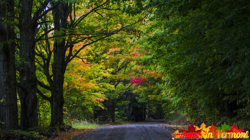
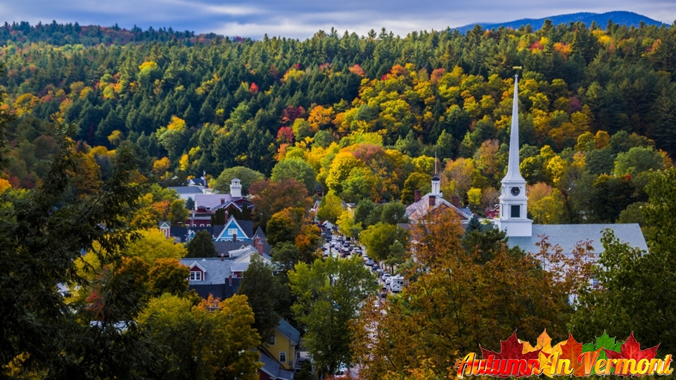
Vermont is perfect for touring by car or motorcycle. Vermont’s scenic routes offer sweeping forest and farmland vistas, quaint villages, and quiet country roads. If you’re visiting Vermont for the fall foliage, here are a number of recommended scenic fall drives in Vermont to take in the best fall colors. People love viewing the colored leaves during fall foliage, but Vermont’s valleys and mountains are enticing all year round. It’s easy to get around Vermont by car.
The Shires of Vermont Byway.
Route 7A. Pownal to Manchester, Vermont.
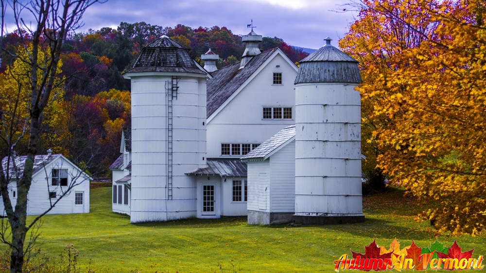
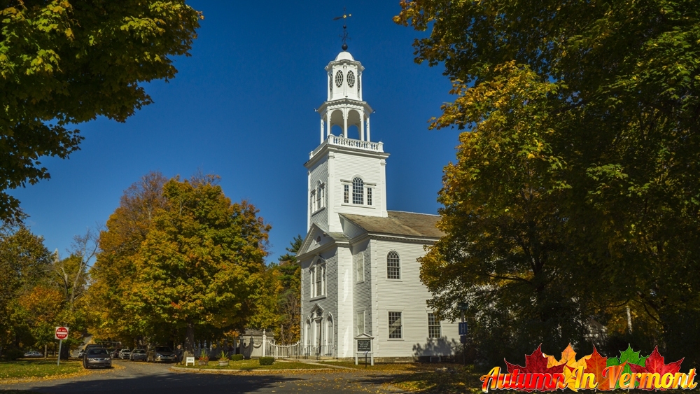
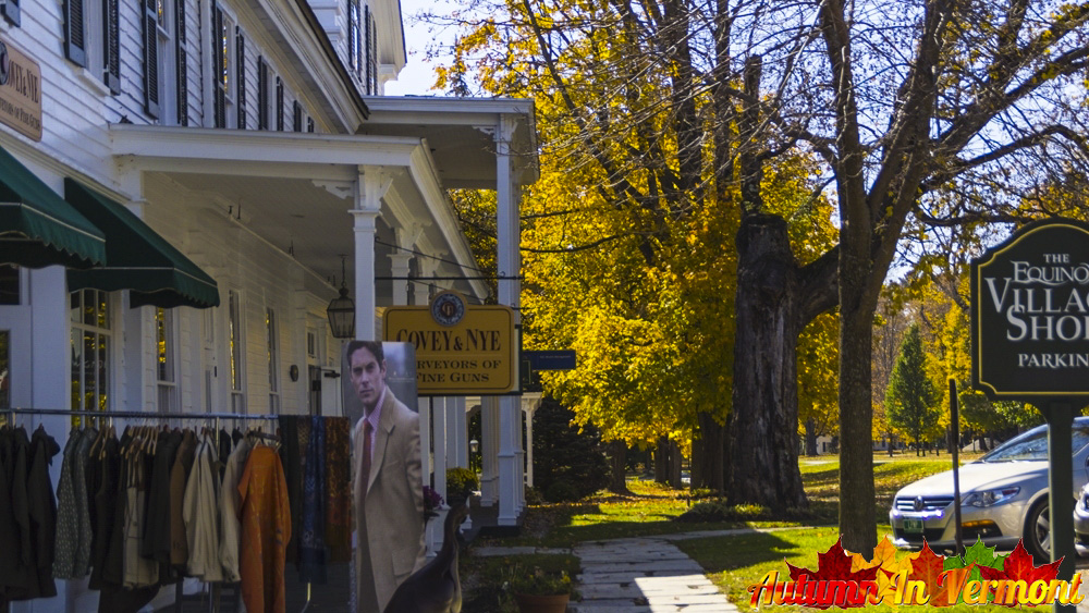
Tucked between the Taconic Mountains and Green Mountains, along Route 7A, the Shires of Vermont is a place of majestic mountain views, brilliant fall foliage, and wonderful towns, including the bookend towns of Bennington and Manchester. Historic Route 7A runs parallel to the Long Trail, a hiker’s path that follows the length of Vermont from Massachusetts to Canada; part of the Long Trail also is the Appalachian Trail. Each town of the Shires has its own ambiance. Pownal has organic farms against a backdrop of mountains. Bennington is a pretty place with interesting dining and shopping. Old Bennington is the home of the Bennington Battle Monument and it is filled with traditional New England architecture. Manchester, a four-season destination, is known today for golf, fishing, skiing, the arts, and shopping.
The Shires of Vermont Byway.
Route 7A Pownal to Manchester, Vermont.
Distance from Pownal to Manchester is 33 miles – an easy distance that allows for a lot of stopping and sightseeing along the way.
Routes 100 and 100B, Granville, Warren Waitsfield, Moretown, Middlesex, Vermont.
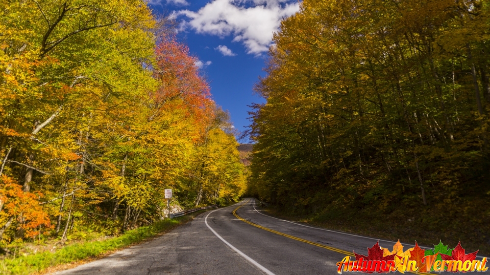
The Mad River Byway is a foray through the heart of Vermont, passing around or through lovely and lively downtowns, farms, famous ski areas (Sugarbush and Mad River Glen), and historic sites. A pleasant walk along the Mad River is accessible via the well-planned, mapped, and landscaped Mad River Path through and around Waitsfield. Driving directions:
The Mad River Byway takes you along two of Vermont’s most scenic roads, Routes 100 and 100B. Along the way you’ll find Middlesex Village (Route 2); Moretown (Route 100B); Waitsfield, Warren, Granville Gulf Reservation (Route 100); Fayston, and Buels Gore to the top of the Appalachian Gap (Route 17).
Mad River Scenic Byway
Routes 100 and 100B, Granville, Warren Waitsfield, Moretown, Middlesex, Vermont.
Length: 35 miles
More information can be found on the Vermont Tourism Web Site.
Connecticut River National Byway.
Route 91 in Vermont; Routes 2 and 3 in New Hampshire, Brattleboro, Bellows Falls, Windsor, White River Junction, Wells River, St. Johnsbury, Vermont.
The Connecticut River Byway parallels and occasionally cross the eastern and western shores of the Connecticut River, which forms most of the border between Vermont and New Hampshire. The byway and its river trace the history of the region from long before the European arrival on this contient. On this byway, visitors can drive across a 465-foot covered bridge that dates from 1866, explore restored historic railroad stations that now serve as waypoint centers, and visit farms, antique shops, artists’ studios and breweries.
Comfortably spaced along the byway are Waypoint Centers that provide a wealth of information and travel amenities, guiding visitors to dining and lodging, locally-made products, recreational opportunities and off-the-beaten track recommendations.
Connecticut River National Byway.
Route 91 in Vermont; Routes 2 and 3 in New Hampshire, Brattleboro, Bellows Falls, Windsor, White River Junction, Wells River, St. Johnsbury, Vermont.
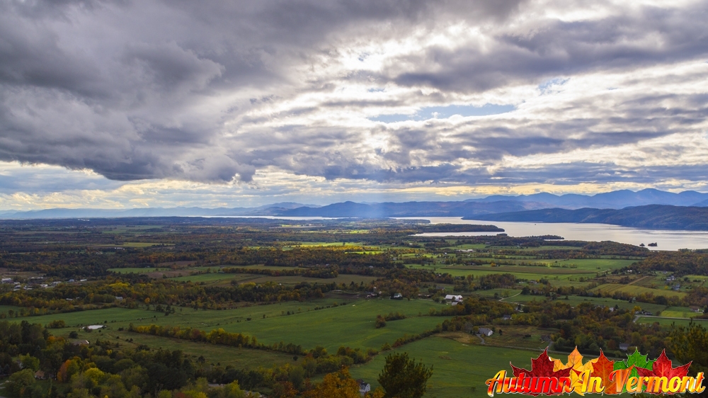
This byway traces the eastern shore of beautiful Lake Champlain, and includes some inland portions near and south of the town of Middlebury. The byway serves up a continuous stream of vistas of mountains, lake, and valleys, of towns and farms. On the Lake Champlain Islands, gorgeous views of the lake can be seen at almost every bend in the road. There are many performing arts venues, local festivals, and historic sites and museums. State parks on the lake are plentiful.
Driving directions: This byway runs along the northern length of Lake Champlain, and uses parts of U.S. Route 2 in the north and U.S. Route 7 in Chittenden. The byway splits and leaves Route 7 in Middlebury.
The byway is named after the popular wife of General John Stark, who led the Colonial militia to a victory at the Battle of Bennington on August 16, 1777. The Molly Stark Byway travels around and through Green Mountain National Forest and its towns and villages. Interesting, must-see towns on the byway are Brattleboro, Bennington, and Wilmington. The scenic byway passes historic districts, hiking trails, state parks, winter sports centers, and lakes.
The byway links famous monuments, unique settlements (like Woodford, the highest village in Vermont at 2,215 feet above sea level), historic districts, hiking trails, state parks, winter sports centers, lakes, streams and waterfalls.
The Green Mountain Byway runs on VT 100 through the towns of Waterbury and Stowe, between the spine of the northern Green Mountains to the west and the peaks of the Worcester Range to the east.
Travel the scenic roads of the Green Mountain Byway on Routes 100 in Waterbury, through Stowe, to Morristown and Hyde Park, and Route 15A in Morristown, Route 100C in Hyde Park and Johnson, Route 15 in Morristown, Hyde Park, Johnson, and Cambridge, and Route 108 in Cambridge and Stowe, and the separately designated Smugglers’ Notch Scenic Highway.
The Stone Valley Scenic Byway features a rich background in slate and marble production, as well as incredible scenic, recreational, and cultural amenities. This segment of Vermont Route 30, spanning from Manchester to Poultney, is highlighted by mountain slopes that provide a dramatic backdrop to the rural landscape and provide access to a host of recreational opportunities.
Located in west-central Vermont, the verdant Stone Valley derives its name from some of America’s most noted marble and slate quarries and mills. Stone created millions of years ago influenced how the region grew and continues to prosper today. The valley and its people also played important roles in the making of the American nation.
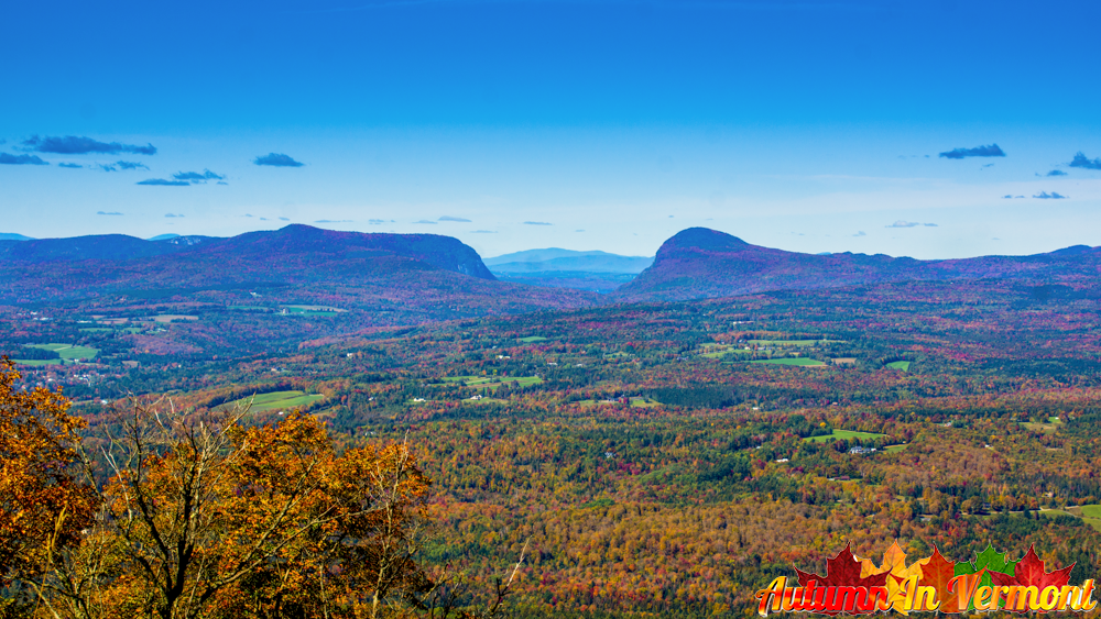
The Northeast Kingdom Byway – a 51-mile corridor including the communities of Saint Johnsbury, Lyndon, East and West Burke, Westmore, Charleston, Derby and Newport – offers endless recreational opportunities throughout the seasons, notable dining and lodging facilities, quintessential Vermont villages resplendent with classic architecture, enduring farmland, and a rich diversity of art, unique shops, entertainment, and events all year long. Formed millions of years ago by the collision of continents, glacial activity and natural erosion, the Northeast Kingdom landscape emerged as rolling hills, rising mountains and pristine lakes. Time and human habitation have softened the edges, leaving thick forests, lush pastures and meandering streams, as well as picturesque villages, enduring farmsteads and impressive historic edifices.
Northeast Kingdom Byway.
Saint Johnsbury, Lyndon, East and West Burke, Westmore, Charleston, Derby and Newport Vermont.
Length: 51 miles
More information can be found on the Get NEKed VT Web Site.